• Home
  • Portfolio
  • Services & Pricing
  • More
    • Home
    • Portfolio
    • Services & Pricing
View Our Work
  • Home
  • Portfolio
  • Services & Pricing
View Our Work

About Texas Aerial Solutions

Our Story


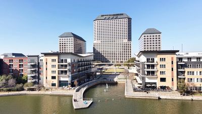
Altitude shifts more than just your position — it shifts your understanding. From above, the landscape reveals a scale and beauty that ground level simply cannot offer. It is a perspective that commands attention, and one that we bring to every project we take on.

That perspective is the foundation of everything we do.

Texas Aerial Solutions was founded on a passion for aviation and a deep belief that aerial imagery is more than just photography — it is a vantage point. Born and raised in the Dallas Fort Worth area, we understand this market, these communities, and what it takes to deliver work that stands out.

From real estate and construction to corporate campaigns and special events, we bring professionalism, precision, and a genuine love of flight to every project we take on.

We do not just capture footage. We elevate your perspective.

FAA Part 107 Certified | Licensed & Insured | Dallas Fort Worth

Our Services

Commercial Property & Exterior Aerial Photography

Commercial Property & Exterior Aerial Photography

Commercial Property & Exterior Aerial Photography

 48MP professional aerial imagery for commercial properties, land, development sites, and multi‑unit complexes across DFW. Exterior‑only coverage designed for marketing, documentation, and investor presentations. 

Commercial & Corporate Videography

Commercial Property & Exterior Aerial Photography

Commercial Property & Exterior Aerial Photography

 Cinematic 4K aerial footage for brand campaigns, corporate marketing, and commercial property showcases. Smooth, stabilized movement with slow‑motion capability. 

Social Media Content Production

Commercial Property & Exterior Aerial Photography

Social Media Content Production

 Native vertical and horizontal 4K aerial content optimized for Instagram, TikTok, YouTube, and LinkedIn. Platform‑ready deliverables for businesses and commercial brands. 

Construction Documentation

Aerial Mapping & Land Analysis

Social Media Content Production

 Weekly, bi‑weekly, or monthly aerial progress updates for developers, contractors, and project stakeholders. Consistent flight paths and time‑lapse‑ready coverage. 

Aerial Mapping & Land Analysis

Aerial Mapping & Land Analysis

Aerial Mapping & Land Analysis

High‑accuracy aerial mapping and terrain modeling for rural land, development sites, and commercial properties. Deliverables include orthomosaics, elevation data, slope and drainage analysis, and clear visual insights for buildability and planning. 

Why Texas Aerial Solutions

FAA Part 107 Certified | Licensed & Insured | DFW

Texas Aerial Solutions is an FAA Part 107 certified drone service provider serving the Dallas Fort Worth Metroplex. Licensed, insured and equipped with the DJI Mini 5 Pro featuring a 1" professional image sensor, 4K/120fps video capability and 36-minute flight time — we deliver premium aerial content that meets the highest professional standards.  Every flight is conducted with full regulatory compliance, comprehensive insurance coverage and an unwavering commitment to safety and quality. 

Aerial drone photography of Las Colinas 
Irving Texas by Texas Aerial Solutions

Follow us on social for updates.

Contact Us

Drop us a line!

This site is protected by reCAPTCHA and the Google Privacy Policy and Terms of Service apply.

Copyright © 2026 Texas Aerial Solutions | FAA Part 107 Certified | DFW Metroplex 

FAA Part 107 | Licensed & Insured | DFW

This website uses cookies.

We use cookies to analyze website traffic and optimize your website experience. By accepting our use of cookies, your data will be aggregated with all other user data.

Accept